Come F.L.O.A.T. In Marion County!
Marion County to release it's fourth Geocaching project!
June 13, 2023Welcome to the Middle of Everywhere, home to the mighty Monongahela River. Commonly referred to as “The Mon“, this 130-mile-long river is famous for its falling banks and winding curves. Additionally, the B&O Railroad used to call this river home with service stretching to Pittsburgh and beyond. Today, walkers, hikers, and bikers get to take in the beautiful views of the Mon while walking on the 25+ mile Mon River Rail Trail. Whether you are floating down the Mon in a kayak or floating down the trail by bike, we hope you enjoy your visit to the Middle of Everywhere.
The F.L.O.A.T. geocaching adventure, also known as Fairmont’s Land or Aquatic Trail, is comprised of 32 play-anywhere wherigo geocaches and spans both the Mon River and the Mon River Trail between Fairmont and Prickett’s Fort State Park. Complete either trail to locate the bonus final container and claim your limited edition F.L.O.A.T. pathtag!
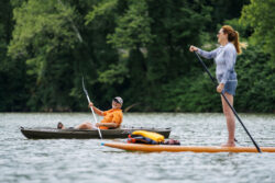
To complete by river …
Your adventure starts at Palatine Park located in downtown Fairmont. Here, you’ll find two launch options, one for kayaks, and one for larger boats, although kayaks can launch at either location.
Kayak Launch : N 39° 28.883 W 080° 08.438
Main Launch : N 39° 29.050′ W 080° 08.100
From here, you’ll embark on an 8-mile down-stream paddle toward Prickett’s Fort. Along the way, you’ll stop to locate small pre-form containers securely attached to trees, branches, and roots overhanging the Mon River. Please be gentle with the caches to ensure the container nor the tree are broken. Depending on water levels, you may need to dismount from your aquatic device to retrieve some caches.
It would be advantageous, if possible, to leave a car at Prickett’s Fort State Park, the take-out point, and shuttle boats back to Palatine Park. It would be a long up-stream paddle back to your car, otherwise!
Looking for local kayak rentals or need more information about kayaking on the Mon River? Check out this article: Marion on the Mon.
To complete by land …
Your adventure starts at the Marion County Trail near downtown Fairmont.
Parking: N 39° 29.325′ W 080° 06.580′
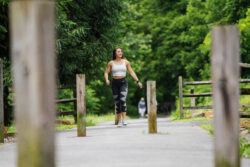
From here, head north on the paved walking trail as you enjoy the 2.5-mile walk, ending at Prickett’s Fort State Park. You’ll pass a variety of different caches, both part of the F.L.O.A.T. geo-art and others. All caches placed for this project are lock-n-lock containers near the edge of the walking trail in kid-friendly locations. Please rehide each cache back better than you found it to ensure muggles don’t spot it; this is a very popular and well-traveled trail
To claim your pathtag …
Once at Prickett’s Fort State Park, cachers who completed either the aquatic or land trails will have the opportunity to find the bonus cache and claim the limited edition F.L.O.A.T. pathtag. To claim your pathtag, keep an eye out for a secret code written on the logbooks throughout the trail. This code will unlock the final container where inside should be a pathtag for you to take or trade. Feel free to leave a pathtag of your own as well!
If there are no pathtags in the final container, please email leisha@marioncvb.com with your name and address and specify that you would like to be mailed the F.L.O.A.T. pathtag.
Let’s go geocaching!
To start, visit geocaching.com and create a free account. CLICK HERE to access the first geocache in the series. Caches numbered #01 – #23 will require a special aquatic device to access. Caches numbered #24 – #31 can be accessed via the Mon River Rail Trail. To solve for the corrected coordinates, please download THIS WHERIGO and enter the corresponding number to the cache you want to find. Correct those coordinates on geocaching.com by clicking the pen tool next to the fake coordinates and you’re ready to go geocaching!
As always, please be aware of your surroundings and take precautions while participating in outdoor activities. Never kayak without a floatation device and ensure you are well-equipped with hydration and nutrition for both segments of your adventure. We hope you enjoy your geocaching adventure, by land or sea, in the Middle of Everywhere!
Special thanks to Jim Whittaker for helping place the kayak portion of this geo-art and
to Kryzstof Kudlak for helping program the play-anywhere wherigo for this geo-art.
Final Coordinates:
| 01: N 39° 29.620 W 080° 07.309 |
| 02: N 39° 29.710 W 080° 07.375 |
| 03: N 39° 29.786 W 080° 07.466 |
| 04: N 39° 29.859 W 080° 07.549 |
| 05: N 39° 29.946 W 080° 07.629 |
| 06: N 39° 30.039 W 080° 07.684 |
| 07: N 39° 30.332 W 080° 07.730 |
| 08: N 39° 30.534 W 080° 07.777 |
| 09: N 39° 30.682 W 080° 07.813 |
| 10: N 39° 30.768 W 080° 07.857 |
| 11: N 39° 30.888 W 080° 07.917 |
| 12: N 39° 30.975 W 080° 07.967 |
| 13: N 39° 31.077 W 080° 07.992 |
| 14: N 39° 31.190 W 080° 07.991 |
| 15: N 39° 31.329 W 080° 07.904 |
| 16: N 39° 31.451 W 080° 07.724 |
| 17: N 39° 31.645 W 080° 07.381 |
| 18: N 39° 31.678 W 080° 07.124 |
| 19: N 39° 31.703 W 080° 06.968 |
| 20: N 39° 31.758 W 080° 06.809 |
| 21: N 39° 31.797 W 080° 06.661 |
| 22: N 39° 31.814 W 080° 06.535 |
| 23: N 39° 31.657 W 080° 06.124 |
| 24 : N 39 29.487 W 080 06.479 |
| 25: N 39 29.750 W 080 06.270 |
| 26: N 39 29.864 W 080 06.197 |
| 27: N 39 30.077 W 080 06.230 |
| 28: N 39 30.152 W 080 06.305 |
| 29: N 39 30.459 W 080 06.264 |
| 30: N 39 30.646 W 080 06.125 |
| 31: N 39 30.788 W 080 06.126 |
| BONUS: N 39° 31.018′ W 080° 05.560′ |


